Weather Arlberg

Weatherforecast

High pressure is falling now and the deep area of low pressure over the North Atlantic will extend to Central Europe. However, low pressure does not necessarily mean bad weather, especially here in the Alpine region. Foehn winds will pick up and be able to keep away any precipitation. They will even bring us occasional sunny spells.
The next few days will only bring small changes.
morning, 02.02.2026
 -4°C/25°F
 50%
 300m
afternoon, 02.02.2026
 2°C/36°F
 90%
 2000m
Tuesday, 03.02.2026
 3°C/37°F
 60%
 2500m
Wednesday, 04.02.2026
 3°C/37°F
 70%
 2300m

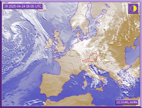
Satellite picture

On the satellite photograph you can see the extended-range weather situation over Europe. The picture shows how the weather will develop in the next hours. If you are planning a ski tour or an off-piste excursion, please observe the developing weather situation on our satellite picture.

Here you can recognise important information on the extended-range weather situation and study the development of bad weather fronts. It is also important not to forget to seek further vital information about the avalanche warning stages before you undertake a trip into the backcountry!